



Search the Blog

Latest Comments
Guest - Aislinn
Dyestuff Citizen Science.
09 October 2026
This is a great project. I look forward to the results. Thanks for letting us know.
Guest - Aislinn
Time for...
09 October 2026
Looks delicious!
Guest - Katrin
Sprang Discussion
18 September 2026
Hi Rachel, I have looked for more photos of you, but that was not very successful. I found a link on...
Guest - Beatrix
Sprang Discussion
15 September 2026
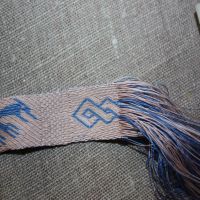
That lozenge pattern element is not a photograph, but a scan. So it should be to scale. But I pinned...
Guest - Katrin
Sprang Discussion
15 September 2026
I was not referring to Rachel's reconstruction (is the reconstruction you refer to the one photograp...
New technology shows old Roman roads.
In the UK, the Environment Agency has used lidar, a modern laser-based surveying technique, to generate 3D maps. Altogether, the data collected covers about 72% of the land surface, and it amounts to about 11 TB. That is a huge amount of data.
While the Environment Agency used it to track coastlines and do planning of things like flood defenses, they've put it online last summer, so you can find it on their survey Open Data site now.
Of course, this is a wonderful tool for archaeologists as well, as the lidar scans can reveal buried structures. Among the archaeologists who have already used the scan data successfully is David Ratledge, who finally found the "missing" Roman road that connected Ribchester and Lancaster.
I always love it when new technology does wonderful stuff for archaeological research!
While the Environment Agency used it to track coastlines and do planning of things like flood defenses, they've put it online last summer, so you can find it on their survey Open Data site now.
Of course, this is a wonderful tool for archaeologists as well, as the lidar scans can reveal buried structures. Among the archaeologists who have already used the scan data successfully is David Ratledge, who finally found the "missing" Roman road that connected Ribchester and Lancaster.
I always love it when new technology does wonderful stuff for archaeological research!
Comments 1

Heather
on Wednesday, 02 March 2016 18:54
Years ago (within 10 years), in my other life, I got to see a new project being undertaken by English Heritage. They were taking satellite images of the whole of England and then making a map (digital permatrace was involved) of all the possible ancient markings to discover new sites. It could be printed square by square and overlaid with the Ordnance Survey map. It was still incomplete when I left - I wonder what became of it?
By accepting you will be accessing a service provided by a third-party external to https://pallia.net/